GIS SERVICES

Small Utility Focused Asset Inventory Solutions

Ownership and Maintenance

Permanent and Transferable Solution

Affordable

GIS as a Service (GISaaS)

As an Esri partner, GISaaS* offers a unique solution for small utilities and municipalities to take advantage of the industry-leading ArcGIS platform. Helping you develop, map, and maintain asset inventory without the burden of supporting in-house GIS hardware, software, and technical staffing. We serve as your GIS department so you can focus on your systems operations. 

GISaaS is a technical subscription service much like a cellular plan or a subscription to a cloud storage service for securing data backups. However, our service includes as-needed access to GIS technical services experienced in editing and managing utility and public works GIS data. We work with your operations staff to maintain your asset inventory data. 

GISaaS’ hosting solution includes dedicated cloud-based GIS servers for hosting your asset inventory GIS and securely serves it to your users using Esri’s ArcGIS Online and mobile applications. The use of cloud-servers manages performance and eliminates system down-time due to localized environmental disruptions.  

Small Utility Focused Asset Inventory Solutions

Smaller utilities and municipalities often see the value in GIS for asset inventory but are challenged with limited in-house technical resources or restrictive budgets to take the leap into this dynamic mapping solution. We’ve created our GISaaS solution to make GIS technically and economically feasible for small utilities with limited resources and staff. 

Our GIS asset inventory solutions include typical municipal and utility assets such as Water, Wastewater, Electric, Stormwater, Roads and Sidewalks, Fiber, Signs, Roads, and more. Likewise, our service can involve Municipal Planning data such as zoning, future land use, districts, incentive zones, annexations, and city limits maintenance. 

EXPLORE

gis_500x500

Ownership and Maintenance

GISaaS works with any existing asset data, in whatever form or format you have (CAD, spreadsheet, PDF Maps, or databases) and will migrate this into an Esri industry-accepted GIS data model. Updates and maintenance are performed as needed from additional data sources or map-based system markups. These map-based system markups are the most important source as they typically come from operations staff who have the most knowledge and experience with the location and details of a utility’s asset inventory. It’s your data, simply organized and consolidated into a single definitive GIS mapping platform for your use. 

Permanent and Transferable Solution

GISaaS can host and manage your utility asset inventory GIS for as long as you need us. We are also aware that as growth happens in a municipality, there may be a time when you would like to establish an in-house GIS department and bring this established GIS home. Our solutions and systems are all built on commercial-off-the-shelf Esri data models and solutions. As such transferring your data to your in-house GIS becomes a simple process and we will assist you in setting up, and data migration to ensure the transition is as smooth as possible.  

Affordable

GISaaS has a tiered hosting subscription to tailor our services to the size and needs of your organization. Beyond the hosting subscription, we offer as-needed technical services to update and maintain your GIS so that it stays current with your capital and maintenance improvements. Technical services are offered at pre-established hourly rates. To make this process easy to manage and reduce paperwork, we recommend setting aside a small portion of your fiscal year budget in a purchase order that can be invoiced against as updates are executed.  

See the attachment for more details on our service and information regarding creative financing options. 

*GISaaS is a unique service line within the George F Young family of services.  

Take Action!

Don’t leave any questions unanswered. Learn more about…

GFY GIS SOUND LIKE A FIT?

Let's Connect!

CALL US NOW

1.877.439.1919

Ready to build the future? See our engineering openings and…

GFY | GIS PROJECTS

GFY | GIS CLIENTS

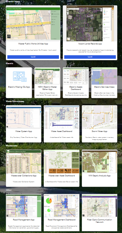
Strong Support Developing our GIS

The Town of Longboat Key needed strong support developing a digitized, asset inventory of all our key utility water and wastewater infrastructure in a portable, transferrable GIS format. George F. Young’s GISaaS program and expertise was what we needed as both a GIS as a service host, and their strong familiarity with utility infrastructure from a field perspective enabled them to more accurately and efficiently capture and corroborate all our field and paper asset data.

Isaac Brownman

Director | Town of Longboat Key Public Works

GISaaS aTop Choice for our Municipality

We have worked with GISaaS for GIS mapping and surveying and are highly impressed. They deliver quality work with meticulous attention to detail. The team is very responsive, answering any questions promptly and kept us informed throughout the process. Their professionalism and expertise make GISaaS a top choice for our municipality!

Mike New, PE

City Manager, Newberry Florida

Want to work with us?

GIS EXPERT